By: Andrew Patrick, KHS Book Review Editor and Subscriptions Coordinator, The Register of the Kentucky Historical Society
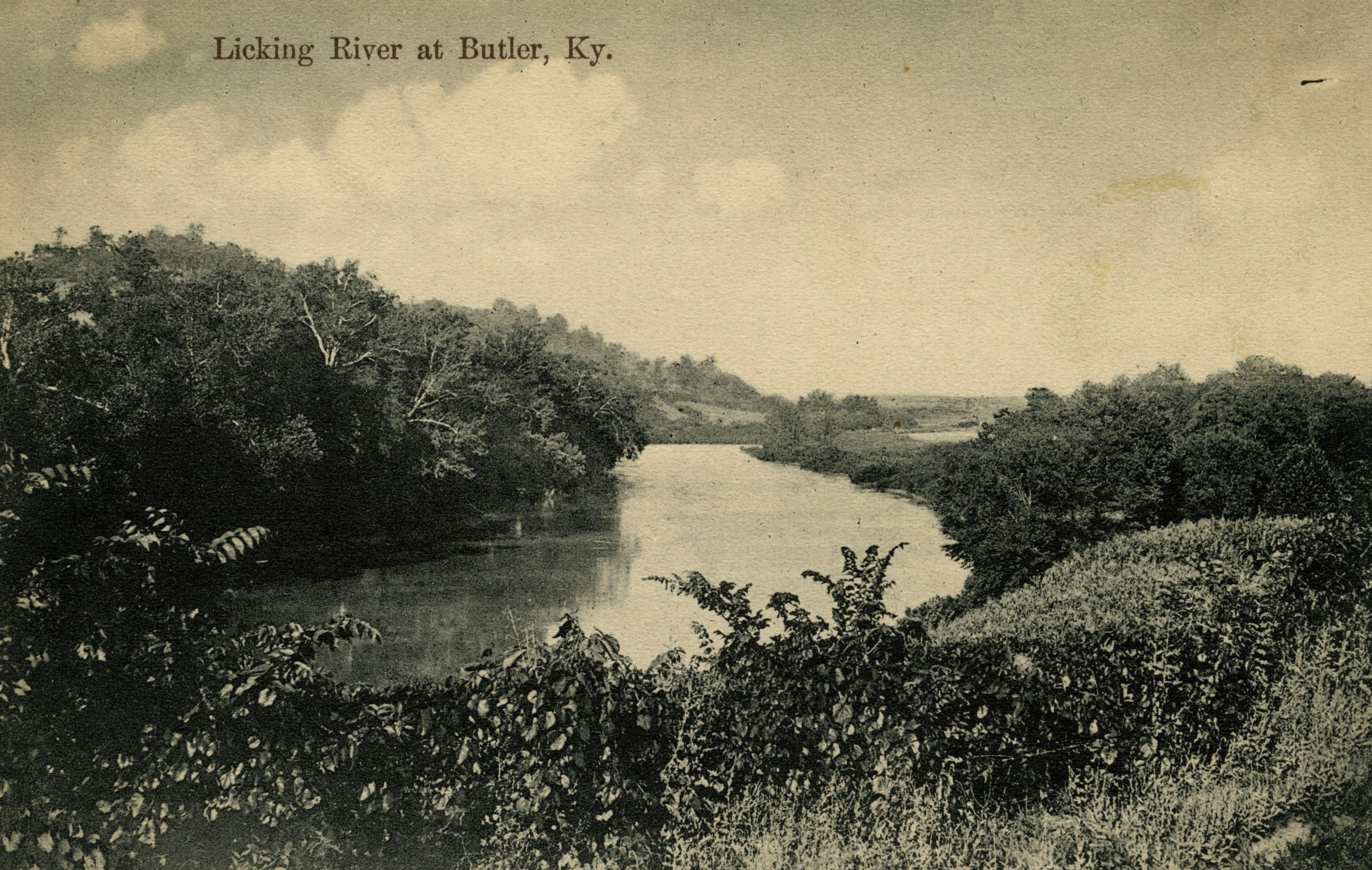
For those of you who may have noted the Licking River as a watercourse along which your family resided, you may want to take a look at the Licking River Navigation Journals. Not only do they give us a descriptive window into the life of someone who had to traverse these waters, but they also give us a snapshot of life along the river during Kentucky’s early settlement years, including family names, structure descriptions, and professions.
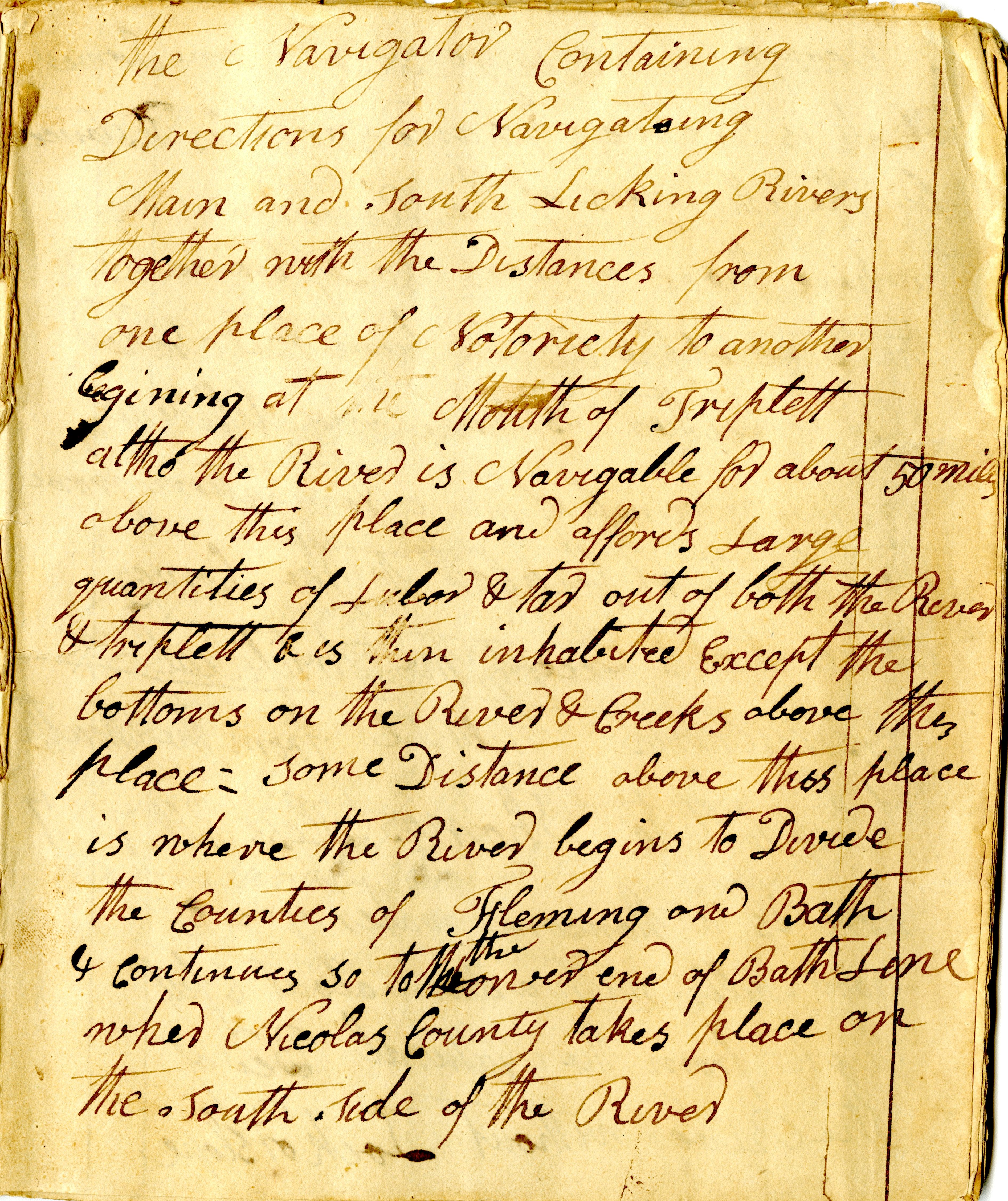
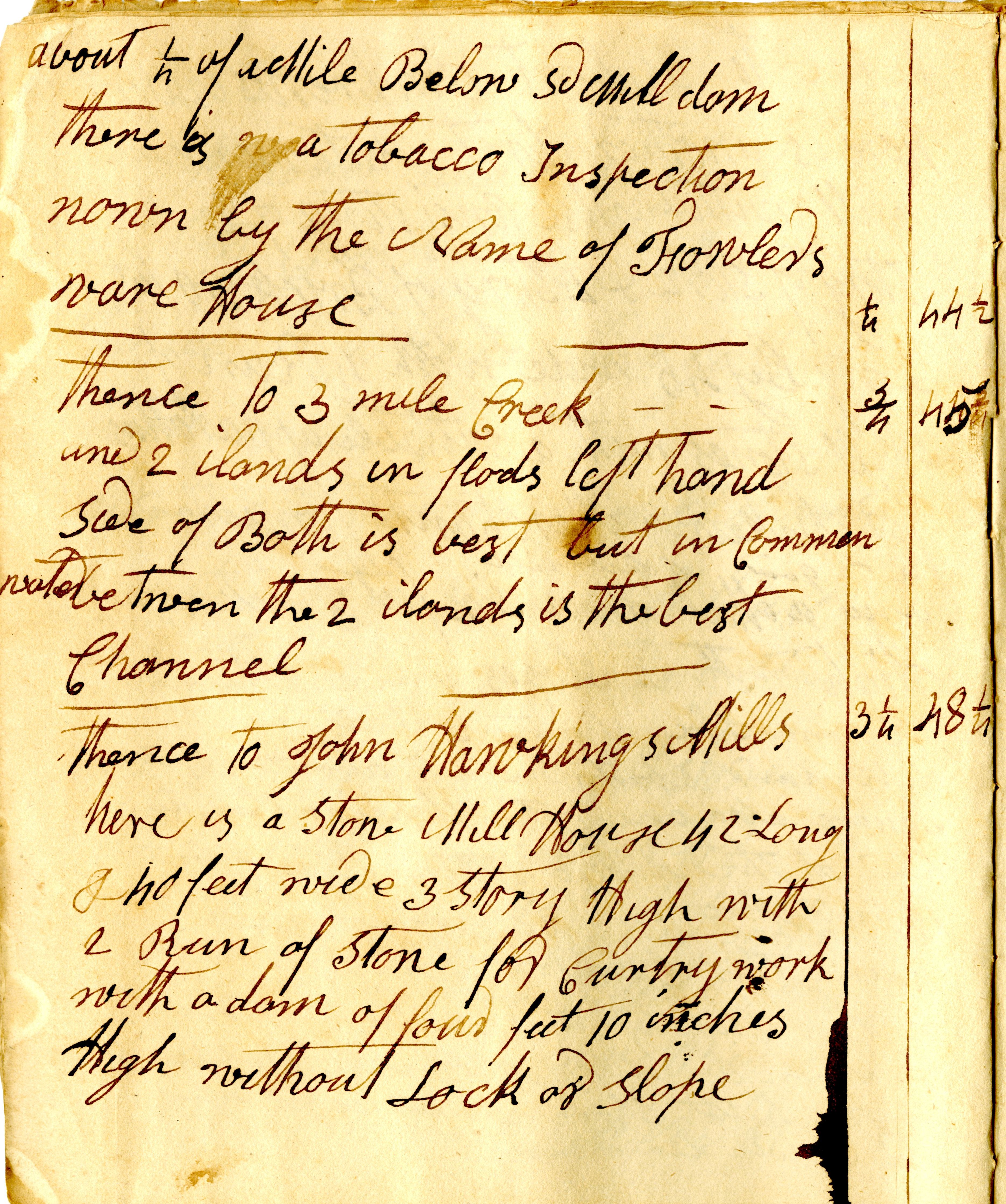
These journals (2 volumes) from 1818 provide first-hand accounts of travelling up the Licking River from its confluence with the Ohio. They note important landmarks on the journey, most prominently tributary creeks and islands, the locations of mill sites and ports, and the residents on the banks of the river. Meant as a field guide to navigation, the journals include high levels of detail about the physical conditions of the river including water levels, potential hazards along the route and distances between typical stopping points. The author identified the landmarks with names that reflected the region’s recent and colorful history including “Dead Man’s Ripple,” “Dutchman’s Ripple,” “Grant’s Island,” and “McLaughlin’s Mill dam.”
The journals demonstrate the complexity of river transportation during the early years of Kentucky statehood. The fixation on locating obstacles in the river and providing a detailed guide to safely navigate them suggest the difficulties inherent in the journey before the waterway was formally surveyed and concerted improvement efforts began.
Another important element of river travel during this time was a knowledge of local residents along the way. The unknown author of these journals did not note everyone who lived on the river, but included the description of saw mills, “tobacco inspection” rooms or “ware houses”, and merchants. The name of the owner is usually provided along with descriptions of the structures that can be found at this site, including building material and dimensions.
The journals have recently been digitized and are available online for free through our Digital Collections Catalog: Licking River Navigation Journals, 1818.
The Licking watershed covers all or part of the following modern counties: Magoffin, Morgan, Menifee, Rowan, Lewis, Fleming, Bath, Montgomery, Clark, Bourbon, Nicholas, Mason, Robertson, Harrison, Bracken, Pendleton, Grant, Campbell, Kenton and Boone.
